This year, we had the opportunity to go to France to attend my friends’ wedding. Since we were making the trip over there, we decided to extend it out into a 2 week vacation. I had never been to France before so of course there were some touristy things that I wanted to hit up. When in Rome, as they say…or when in Paris? Anyways, D had already been to Paris before and didn’t really enjoy it that much. To try and strike a somewhat middle ground, we decided to spend our first 3 days down in Fontainebleau.
Fontainebleau is a town about 45 minutes south of Paris as well as the name of the surrounding forest area. Fontainebleau forest is one of the best places to boulder in Europe, if not the world. The town itself is accessible by train from Paris although the bouldering sites themselves often require use of a car. The different bouldering sites cover varying degrees of difficulty and rock types. I got a lot of info for my trip from BoulderFont. From this site, I was also able to find a place to stay. The area I wanted to climb in is called Les Trois Pignons, situated on the south western side of the forest. What really made me want to go there was the sand covered bottom of the forest. It looked incredibly beautiful in all the photos I saw and the rock there was supposed to be smoother, and less jagged. About a 10 minute drive from that part of the forest is a small town called Tousson, home to a gite run by a group of friendly climbers called The House. The House has several rooms for rent with access to off street parking, common spaces, and kitchen. You get a private room, bedding, bathroom, and free crashpad rentals for the duration of your stay. Pretty perfect if you ask me.
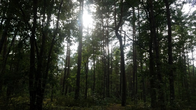
The day after we flew in to CDG, we picked up our rental car and made the drive down to Tousson. We happened to arrive at the start of a heat wave so we waited until about 5 to go out and explore. I picked the closest parking lot to us a couple towns over and we drove over. Les Trois Pignons can be further broken down into different boulder clusters. We started down the first path we saw from the parking lot and began walking. It took me a bit to actually figure out where we were in relation to the map I had, but I think we ended up around in the Roche aux Oiseaux area. It was a large pocket of boulders in a wooded area. We played around for a bit, even though it was probably around 90 degrees out. Eventually we concerned to head home, still a bit tired from the time difference.

One thing we did not consider, was that small town grocery stores close at 12pm on Sundays. Luckily, there was some spare pasta in the pantry for poor souls such as ourselves, so we had a pasta with olive oil dinner that night.
The next few days we really struggled to overcome the jetlag. The heat wave also didn’t help. The next day we made a point of going to the grocery store first. There was one about 10 minutes away. Once we ate lunch, we headed back out to our default parking lot. Now that I had an idea of where we were, I wanted to find my sandy basin. Instead of taking the first path, we took the one that was deeper into the parking area. This path had an actual billboard with a map of the area.
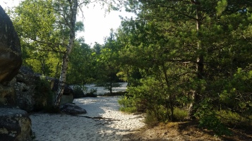
Cul de Chien was my ultimate goal so we headed in that direction. We hit an intersection that was pure sand leading off the path so I figured that was the right way to go. We were once again stymied by the heat so we stopped at the first boulder field we found which turned out to be Roche aux Sabots. Similar to Cul de Chien, a boulder field surrounded by smooth white sand. We setup our stuff there and proceeded to find some routes. The circuits at Sabots were at least marked so we had some idea of the difficulty. The ones here were more in my range of climbing ability so we climbed around for quite a bit.
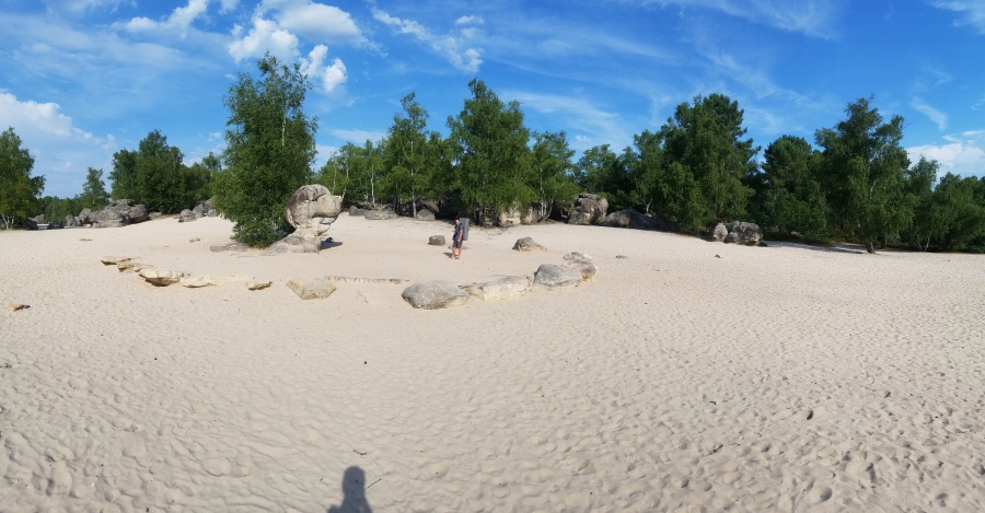
I’m not used to having trips like this. Trips with a lot of downtime and you just go at your own pace. I tend to be too lazy about it and kind of idle time away, which is unfortunate. I think D is the same. We need something a little more structured than us just meandering around the French countryside. Our last day in Tousson began like the rest. Hot. Today we were going to make it over to Cul de Chien. Like clockwork, we set out for the forest, made our way past Roche aux Sabots, and veered off to the side where you could see a sweeping playa of sand. This was what I had seen in the pictures. A massive sand field bordered by some boulder fields and bright green trees, along with the titular dog shaped rock.

The other places we had climbed at were larger than the rock clusters in the Bay Area. However, Cul de Chien was even larger. Rock after rock, the boulder’s just kept coming. We could probably spend another few days just boldering there and we wouldn’t be able to try all the problems. I guess that’s part of why Fontainebleau is so popular. The diversity, and shear number of available problems is massive. We climbed until we got too hungry and hot to climb anymore then headed back to the car. In hindsight, it probably would’ve been a lot more fun if we had a group of people climbing. More social momentum. If we ever get the chance to come back, I’d definitely come. Maybe my french would be better then too.
References
I actually had a hard time finding a good reference route guide for the area. I ended up getting Fontainebleau Climbs: The Finest Bouldering and Circuits
In all honesty it was an alright guidebook. Pointed out good areas to go and where the trailheads were but the actual route map left a little more to be wanted. Most routes are indicated by number bubble on a rather crude line drawing from a birds eye view. I appreciate more route photos and diagrams in my climbing guides but maybe that’s just me.
Disclosure: This part contains affiliate links. I’d like to be able to provide more thorough content on the site and this is a way to support that upkeep.
