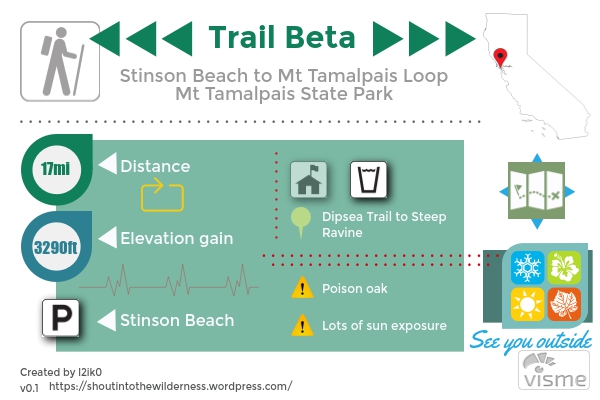
TL;DR
See every ecosystem Mt Tam has to offer in this 17mi loop from the beach to the top of East Peak and back. The mileage might seem daunting but the hike wasn’t all that bad with 95% of the elevation gain in the first half. We took the longer way down to save our knees.
Thoughts
Lately, I’ve been contemplating how to see more within a weekend. My must-do list of hikes grows faster than I can keep up with and there are only so many vacation days in a year. If time is minimized but mileage keeps increasing that means rate must be increased. More miles per day means going farther, seeing more, having more time to actually spend at your destination, lower pack weights, less days on the trail, ..all assuming your body can keep up. I get inspired when I see people train and push themselves to do crazy feats like Grand Canyon Rim-to-rim-to-rim in under a day. JMT sub 2 weeks. Why can’t I be strong? Fit? Now’s the time to try, right? I mean I can do a 10 mile day backpacking, but what if I could do 15? Or even 18? A lot more possibilities then.
Its hard to find a cohesive group that also has that goal in mind though. High mileage days aren’t easy. It takes a certain amount of mental fortitude and/or stubbornness to make it through the zombie mode at the end of a long day. Not to mention the aches and pains. Out of the blue, one of our friends starts talking about how he wants to do 40 mile weekends. Talk about coincidence. With that in mind, we arranged for our first long hike to be Stinson Beach to Mt Tam. It was on my list for Inca Trail training but never got around to doing it. Its easy to get to and while long, isn’t terribly brutal in terms of elevation. Game on.
Our day started around 8:30am, pulling into the Stinson Beach parking lot. Starting early also enables you to actually get parking as this lot fills up quick on the weekends. From there we walked back out toward Hwy 1 following signs for Dipsea Trail. The beginning of this trail is a decent incline that will get you working right off the bat. Most of the vegetation is brush until you turn off onto the Steep Ravine Trail. Then its a redwood wonderland.
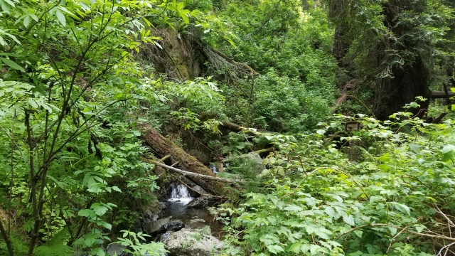
The Steep Ravine Trail is appropriately named. While its the shortest route up from Stinson, I wouldn’t want to come back this way. The trail is steep and muddy in some parts with lots of roots that you could trip over. Tall redwoods shade the first couple miles making for a very pleasant start. Steep Ravine spits you out at the Pantoll 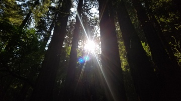 Campground where you have to cross over Panoramic Hwy to continue on the Matt Davis Trail. You pass by Bootjack Campground and meander around the side of the mountain until you climb up to West Point Inn. You get some views of the Marin Headlands here but not much. From there we continued onto Old Grade Road which is a widish fire road that isn’t terribly exciting. We took this all the way to the top.
This was actually the first time I’ve been to East Peak on Mt Tam. The parking lot area has restrooms, water, and a small convenience store. We ate lunch and relaxed on the warm pavement. At this point, we were 8 miles in. After lunch we went up to tag the summit. I never realized there was rock climbing on Mt Tam. We saw a bunch of people with racks and crashpads. Apparently you can belay off the top and there are some descent routes. From the summit parking lot, we followed Ridgecrest Blvd back out to Middle Peak Rd (another fire road) to Lakeview Trail to International Trail. Mt Tam is a literal spiderweb of trails. If I didn’t have access to a map we would’ve been wondering around in there for days. International Trail turns into Northside Trail which then hits Portrero Meadows. We barely saw anyone on this side of the mountain. A few people hiking, and a couple cyclists but nothing compared to the normal Mt Tam crowds.
The vegetation was definitely a bit dryer on this side too. Similar evergreen forests but 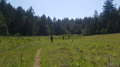 larger grassy meadows and less water. We’re now about 14 miles in and we’re starting to want this to be over. Potrero Meadows becomes Barth’s (yeah Barth) Retreat Rd becomes Mickey O’Brien Trail and then you top out on Mt Tam’s signature hills over Ridgecrest Blvd. Now the real descent begins.
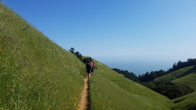
Willow Camp to the Coastal Trail which was the narrowest trail of the day. 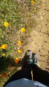 Flowers dotted all the hillsides, it wasn’t a superbloom, but still very pretty as we approached the end of our hike. The Coastal Trail meanders in and out of the hills for a mile or 2 and then meets up with the Matt Davis Trail for a solid mile of switchbacks covered in poison oak. Matt Davis Trail dumps you out at the Stinson Beach Fire Station, down the street from the beach parking lot. 17 miles done and it wasn’t all that bad to be honest. Granted, we just had day packs and had a pretty leisurely elevation profile. But it was a good starter high mileage hike and beautiful as well. Like all things, time flies when you’re in good company.